ROUTES
Here you will find a selection of Routes that will suit most SCC Members.
SCC Ride ‘Leaders’ will be using these routes to advertise to SCC riders before the event, so you can choose to attend or not depending on your level of fitness etc…
RIDE ‘LEADERS’
Copy the link (right Click / Copy Link Location) below for your route & paste it into the SCC Facebook, Forum, Blog, Whatever, to promote your ride…. Enjoy!!
https://skiptoncyclingclub.org.uk/?page_id=340#route1
https://skiptoncyclingclub.org.uk/?page_id=340#route2
https://skiptoncyclingclub.org.uk/?page_id=340#route3
https://skiptoncyclingclub.org.uk/?page_id=340#route4
https://skiptoncyclingclub.org.uk/?page_id=340#route5
https://skiptoncyclingclub.org.uk/?page_id=340#route6
https://skiptoncyclingclub.org.uk/?page_id=340#route7 [Hill Legs Test]
https://skiptoncyclingclub.org.uk/?page_id=340#route8
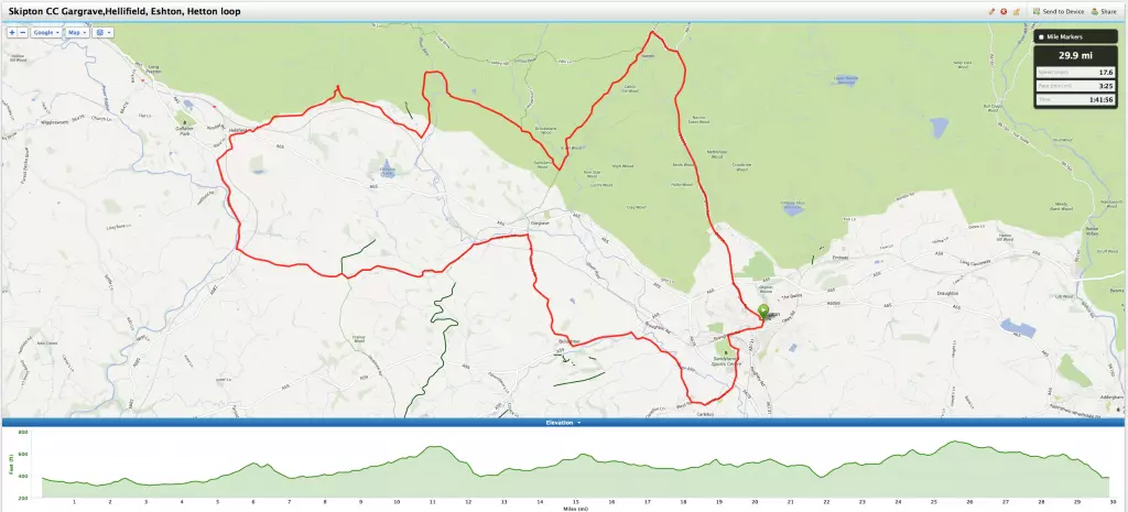
ROUTE #1
Skipton – Gargrave – Hellifield – Eshton – Hetton – B6265 Thrash – Skipton
| Distance: | 30.10 mi (48.44km) |
| Time: | 1:42:38 |
| Avg Speed: | 17.6 mph |
| Elevation Gain: | 1,935 ft |
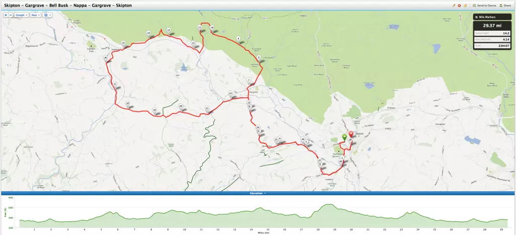
ROUTE #2
Skipton – Gargrave – Bell Busk – Nappa – Gargrave – Skipton
| Distance: | 29.55 mi (47.55km) |
| Time: | 2:04:55 |
| Avg Speed: | 14.2 mph |
| Elevation Gain: | 1,818 ft |
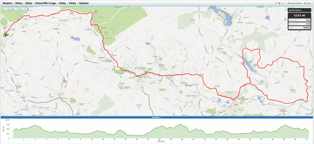
ROUTE #3
Skipton – Ilkley – Otley – Almscliffe Crags – Otley – Ilkley – Skipton
| Distance: | 52.74 mi (84.87km) |
| Time: | 4:00:54 |
| Avg Speed: | 13.1 mph |
| Elevation Gain: | 3,632 ft |
ROUTE #4
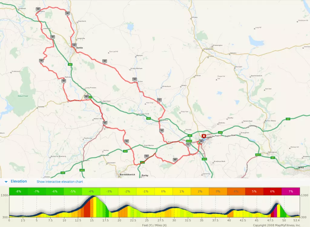
Skipton – Gargrave – Airton – Settle – Austwick – Wigglesworth – Nappa – Thornton in Craven – Skipton
| Distance: | 52.74 mi (85.96km) |
| Time: | No Data Yet |
| Avg Speed: | No Data Yet |
| Elevation Gain: | 2,549 ft (777m) |
ROUTE #5
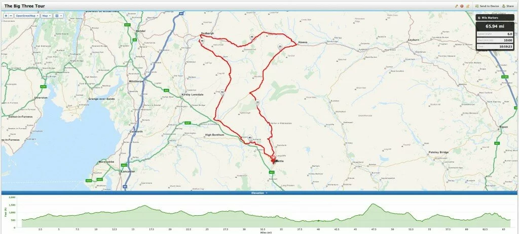
Settle – Horton-In-Ribblesdale – Ribblehead – Hawes – Sedbergh – Dent – Kingsdale – Thorton-In-lonsdale – Ingleton – Clapham – Austwick – Feizor – Settle
| Distance: | 65.94 mi (106.12km) |
| Time: | No Data Yet |
| Avg Speed: | No Data Yet |
| Elevation Gain: | No Data Yet |
ROUTE #6
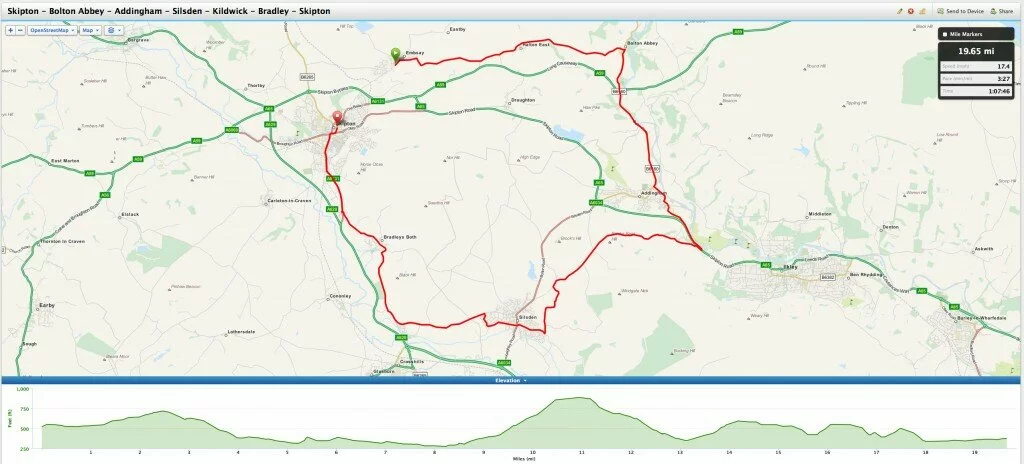
Skipton – Bolton Abbey – Addingham – Silsden – Kildwick – Bradley – Skipton
| Distance: | 65.94 mi (106.12km) |
| Time: | No Data Yet |
| Avg Speed: | No Data Yet |
| Elevation Gain: | No Data Yet |
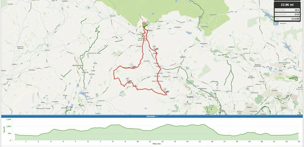
ROUTE #7 [Hill Legs Tester]
Skipton – Pale Lane – Lothersdale – Cowling – Green Sykes Rd (left before Laycock) – Sutton-In-Craven – Glusburn – Kildwick – Bradley – Skipton
** NOTE: There are PLENTY of escape routes along the way in-case you have had enough… Simply ride down to the valley back to Skipton **
| Distance: | 23.09 mi (37.16km) |
| Time: | No Data |
| Avg Speed: | No Data |
| Elevation Gain: | 2,976 ft (907.08mtrs) |
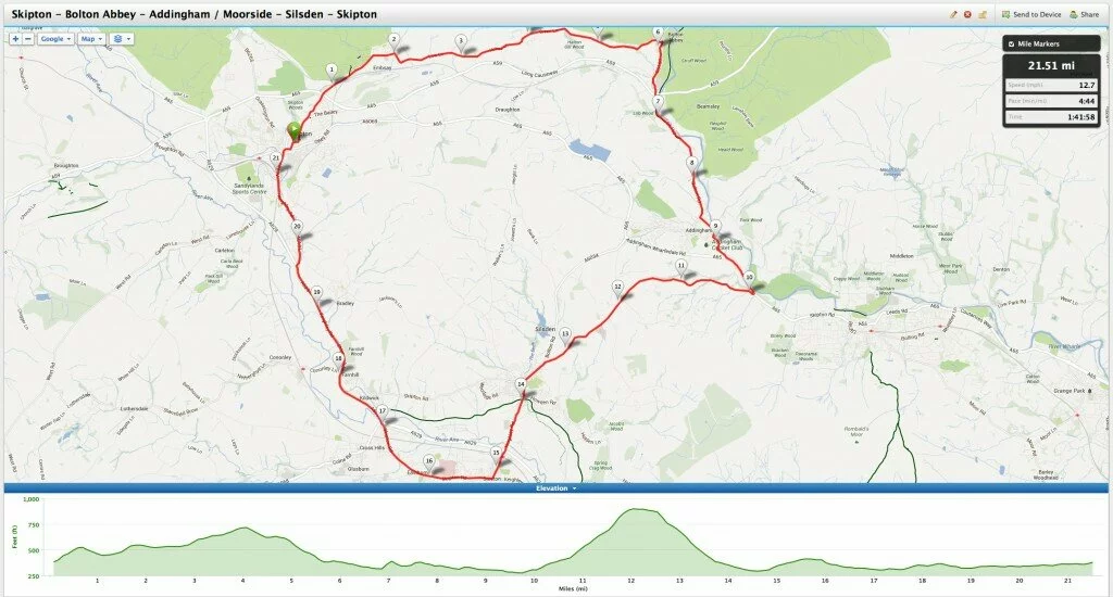
ROUTE #8
Skipton – Bolton Abbey – Addingham / Moorside – Silsden – Airedale Hospital (Main Road) – Skipton
| Distance: | 21.51 mi (34.61km) |
| Time: | 1hr 41mins |
| Avg Speed: | 12.7MPH (20.43KPH) AVG |
| Elevation Gain: | 1,604 ft (488.89mtrs) |
 Follow us on Twitter
  Connect on Facebook


[…] ROUTES […]